


Voting District 0015, Wichita County, Texas
About
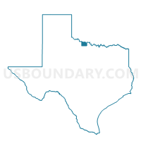
Outline

Summary
| Unique Area Identifier | 678171 |
| Name | Voting District 0015 |
| County | Wichita County |
| State | Texas |
| Area (square miles) | 14.06 |
| Land Area (square miles) | 14.04 |
| Water Area (square miles) | 0.02 |
| % of Land Area | 99.84 |
| % of Water Area | 0.16 |
| Latitude of the Internal Point | 33.85617500 |
| Longtitude of the Internal Point | -98.45520800 |
Maps


Graphs
Select a template below for downloading or customizing gragh for Voting District 0015, Wichita County, Texas


Neighbors
Neighoring Voting District (by Name) Neighboring Voting District on the Map
- Voting District 0002, Archer County, TX
- Voting District 0011, Clay County, TX
- Voting District 0012, Archer County, TX
- Voting District 0012, Clay County, TX
- Voting District 0012, Wichita County, TX
- Voting District 0013, Wichita County, TX
- Voting District 0017, Clay County, TX
- Voting District 0017, Wichita County, TX
- Voting District 0018, Wichita County, TX
- Voting District 0030, Wichita County, TX
Top 10 Neighboring County Subdivision (by Population) Neighboring County Subdivision on the Map
- Wichita Falls CCD, Wichita County, TX (108,679)
- Henrietta CCD, Clay County, TX (6,830)
- Holliday CCD, Archer County, TX (5,440)
Top 10 Neighboring Place (by Population) Neighboring Place on the Map
Top 10 Neighboring Unified School District (by Population) Neighboring Unified School District on the Map
- Wichita Falls Independent School District, TX (87,802)
- Henrietta Independent School District, TX (5,771)
- Archer City Independent School District, TX (3,018)
Top 10 Neighboring State Legislative District Lower Chamber (by Population) Neighboring State Legislative District Lower Chamber on the Map
Top 10 Neighboring State Legislative District Upper Chamber (by Population) Neighboring State Legislative District Upper Chamber on the Map
Top 10 Neighboring 111th Congressional District (by Population) Neighboring 111th Congressional District on the Map
Top 10 Neighboring Census Tract (by Population) Neighboring Census Tract on the Map
- Census Tract 122, Wichita County, TX (6,376)
- Census Tract 303.01, Clay County, TX (4,683)
- Census Tract 116, Wichita County, TX (4,401)
- Census Tract 201, Archer County, TX (2,660)
- Census Tract 115, Wichita County, TX (2,565)
- Census Tract 117, Wichita County, TX (2,303)
- Census Tract 118, Wichita County, TX (1,997)
- Census Tract 113, Wichita County, TX (1,313)